Showing posts with label parkrun. Show all posts

Monday, June 26, 2017

As I Was Saying

Mystery OOM Map Extract
So, parkrun. Any future in it? Five years ago I tried it for the first time. Since then it has grown and grown, and my personal tally now stands at 32 races and I'm wondering how long it will take me to get to 50. We are spoilt for choice around here, and Verulamium has been joined by Ellenbrook Fields, Panshanger Park, Cassiobury, Gadebridge and Fairlands Valley, all within 20 kilometres of St Albans (and all mapped Hertfordshire Orientering Club areas as well). Still a simple concept, brilliantly executed.

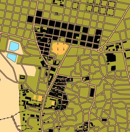
Meanwhile back at orienteering, another of the things I wrote about was OpenOrienteeringMap. This is still going strong as well, and has a solid user base in this country, and the unbelievable ability to generate an orienteering map of just about anywhere in the world. A small prize if anyone finds me and can say where the map extract is from. Anyway, Hertfordshire Orienteering Club now have a Tuesday night series of 45 minute score events throughout the summer, most of which use OOM. You can see examples on HH Routegadget site, like this race in St Albans, and this one in Hertford. Numbers at these Tuesday night events are gradually moving up, and what started with 10 as a good turnout now sees 20 or more most evenings. What's even more encouraging is that quite a lot of these are complete newcomers to the sport.

And that has conveniently dragged Routegadget into the conversation. Back in 2013 I was somehow talked into trying to implement a Javascript version of what was originally a Java application. (Nerd humour alert: Java is to Javascript as Ham is to Hamster. Or Car is to Carpet. Or various other versions I'm sure.) Routegadget needs a few pages of its own, so we'll leave it there for now.

But now we must return to where this blog started: the World Orienteering Championships. This year WOC is in Estonia.  I've never orienteered in Estonia. James fancied going somewhere to fill up the long summer holiday. And so we're off to Estonia on Friday to follow the GB team, and sample the delights of some maps that have quite a lot of brown (with some interesting contour detail) but possibly more green and blue than is ideal. Time to get back into spectator-geek mode. Watch this space.

Saturday, May 19, 2012

St Albans parkrun

Not the most technical course even by Verulamium standards
Parkrun keeps coming up when people discuss how orienteering should be attempting to present itself, and today I got a first chance to try it out. The St Albans version started in January this year in Verulamium, one of our regular Saturday Series areas. This was also a chance to work out how we might need to modify Saturday Series arrangements to avoid any clash.

The idea is very simple: a 5km run held every Saturday morning in the same place. Entry is free but you need to register on the website beforehand. This allows you to print off a bar code to take with you. Then all you need to do is turn up on the start line and join in. I set off with 120 other runners as the bells of St Michael's Church chimed 9.00 o'clock. A show of hands on the start line showed quite a high proportion of first timers like me (nearly a third looking at the results) but the course instructions were quite simple: follow the guy in white and do three laps of the lake.

The race itself was pretty much what I expected: a few fast guys at the front, a few walkers at the back and quite a cross-section of shapes, sizes and speeds in the middle. I set off too fast as normal, and got passed by people as the race went on, including two runners about half my height who turned out to both be 14. Three laps of the lake is just about manageable before terminal boredom sets in and then it's just a short sharp 5 metre climb to the final long flat finish straight. My target had been 22 minutes so 21:55 was perfectly acceptable even if my watch did only register 4.95km. Maybe next time I won't do 5 km beforehand running to the start from home. After crossing the finish line you are given a small plastic tag with a finish position and bar code on it: the modern equivalent of the good old raffle ticket which nearly made it in at number 2 on my list of orienteering things you didn't know you had missed. Results are done using a phone to read your registration bar code (carefully retrieved from a plastic bag in the pocket on my shorts) and your finish tag, and the correlated with finish times recorded on the finish line. Results were on the website that afternoon and I even got a text message telling me how I had done.

So why is this proving so successful and what can orienteering learn from it?

The format is simple, easy to understand and accessible. Everybody has a reasonable concept of what 5 kilometres on a surfaced path involves. It's far enough to be a worthwhile run for most, but short enough not to put people off. And you don't need to keep looking at the fixtures list to find when the and where the next event is.

The technology is used very effectively. The website is attractive and informative. Registration and timing bar codes are simple and work well.

Requirements for volunteer effort are relatively small. Eight people are acknowledged on the results page. I spotted one finish timer, two on results download, and three or four marshals on the course.  Doing away with registration by asking people to do it on the website is a key saving.

It's free. To be honest I'm sure people would be willing to pay one or two pounds if asked, but if the financial model doesn't need it then this can surely only help to increase attendance.

Much of this is of course is where Orienteering on demand is trying to go.