 The new release of Catching Features has finally arrived. If you've never tried it then I suggest downloading the demo immediately, and then paying your money to buy the full version. It is a fantastic orienteering simulation, with a huge range of maps and courses to try out, plus a world-wide ranking system and on-line competitions. Don't miss downloading the World Championships maps and courses from Japan 2005, Sweden 2004 and Switzerland 2003.
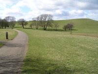
The main feature of the new release provides a vastly improved map conversion utility. This takes in an OCAD map and spits out a virtual model of the map that you can then set your own courses on. People have managed to make some pretty impressive maps with the old editor, but it was hard work and took a long time. The new editor is simply amazing. I've had a quick play with some real OCAD maps and within just a few minutes you can produce very accurate conversions. As an example, the left-hand picture is a screen shot from a conversion of Campbell Park, as used for the British Sprint Championships this year. The right-hand picture is one of the photos I took whilst checking sites before the race. The main difference is the fence in the converted map, which hadn't been put up when I took the photo!
I'm sure we'll start to see even more conversions of world-class areas in the near future so you can spend the long dark nights practicing your O technique, just like Thierry does. It strikes me that we could be getting close to a new discipline: indoor orienteering. It doesn't look too difficult to connect Catching Features up to a treadmill, and then you could make the running speed in the game proportional to the speed of the treadmill. You could then have indoor orienteering races just like they have indoor rowing world championships on rowing machines. Just a thought.
No comments:
Post a Comment